
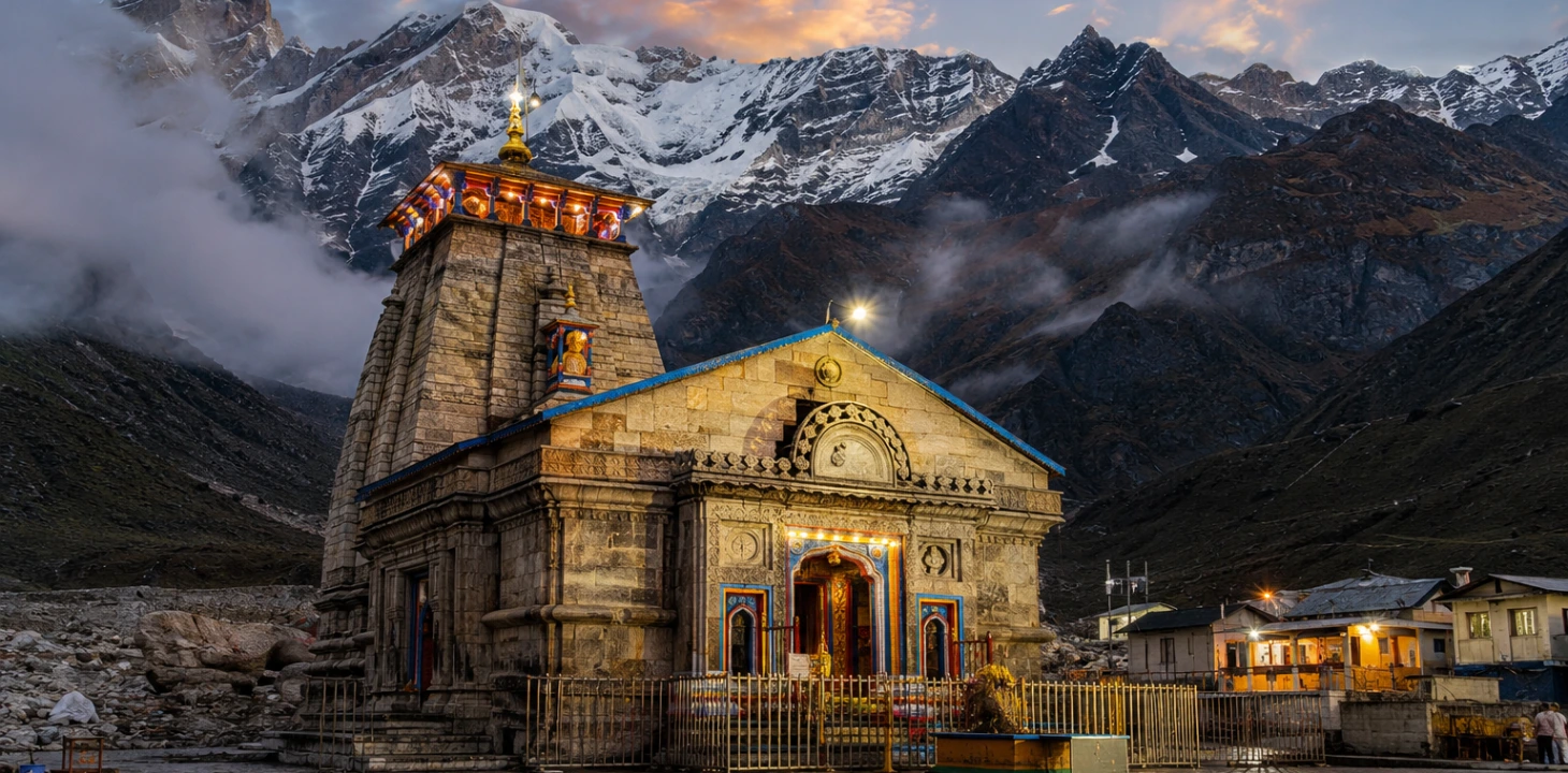
Kedarnath Temple & Yatra Guide
Kedarnath is a Himalayan temple town in Rudraprayag district, Uttarakhand, home to one of the twelve Jyotirlingas of Lord Shiva and one of the four shrines of the Chota Char Dham. Sitting at roughly 3,583 metres on the bank of the Mandakini river, it is reached by road up to Gaurikund or Sonprayag, followed by a mountain trek (or helicopter) to the temple itself. Most pilgrims travel here as part of a wider Char Dham Yatra route, starting from Haridwar, Rishikesh, or Dehradun.
A Look at the Temple & the Trail
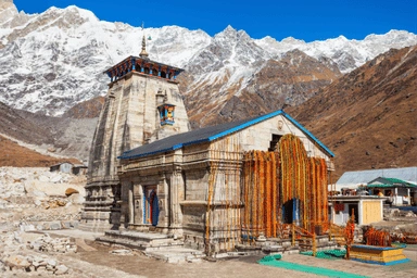
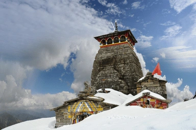
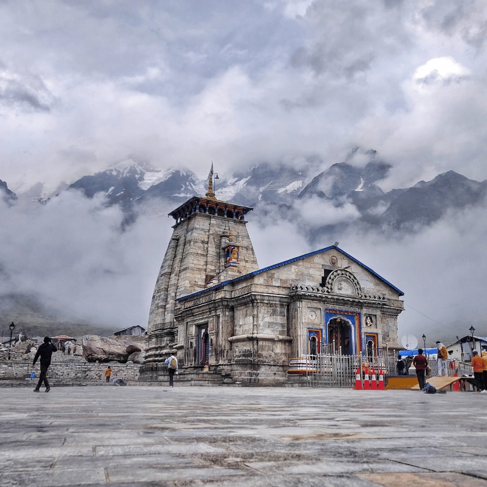
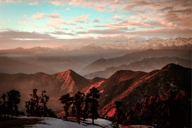
From the stone-built temple by the Mandakini to the winding Gaurikund trail, here's what the journey looks like.
What Is Kedarnath, and Why Do Pilgrims Travel Here?
Kedarnath is a temple town cradled in the Garhwal Himalayas, in the Rudraprayag district of Uttarakhand. The Kedarnath Temple, dedicated to Lord Shiva as one of the twelve Jyotirlingas, stands on the bank of the Mandakini river at an elevation of roughly 3,583 metres, surrounded by snow-lined peaks for most of the year. It is one of the four shrines of the Chota Char Dham circuit (alongside Yamunotri, Gangotri, and Badrinath) and part of the Panch Kedar group of Shiva temples spread across the region.
According to local legend, the temple's origins are tied to the Pandavas of the Mahabharata, who are said to have sought Lord Shiva here to atone for the events of the Kurukshetra war. The present structure, built from massive interlocking grey stone slabs, is widely associated with a later restoration credited to Adi Shankaracharya, the 8th-century philosopher-saint. What draws travellers today is a mix of faith, remoteness, and scale: a stone temple that has stood through centuries of Himalayan winters, reachable only on foot, by pony, palki, or helicopter from the last motorable point.
For most visitors, Kedarnath is not a stand-alone trip — it's one stop on the wider Char Dham Yatra route, often combined with Badrinath, and started from a base like Haridwar, Rishikesh, or Dehradun where a Char Dham taxi is arranged for the onward hill journey.
How to Reach Kedarnath
Kedarnath has no direct road or rail access — every route funnels through the hill town of Gaurikund or the nearby transit point of Sonprayag, the last point vehicles can reach. From there, the temple is approached on foot, by pony/mule, palki (palanquin), or helicopter. Most pilgrims first travel by road from Haridwar, Rishikesh, or Dehradun to Sonprayag/Gaurikund using a private taxi, then complete the final stretch on the trek. See our Char Dham Yatra route map for how Kedarnath fits into the full circuit.
| Route | Approx. Distance | Approx. Time | Details |
|---|---|---|---|
| Haridwar to Kedarnath (via Gaurikund) | ~210–220 km | 9–11 hrs | Full distance guide |
| Rishikesh to Kedarnath (via Gaurikund) | ~200–210 km | 8–10 hrs | Full distance guide |
| Dehradun to Kedarnath (via Gaurikund) | ~225–240 km | 9–11 hrs | Dehradun Char Dham taxi |
| Gaurikund to Kedarnath (trek) | ~16–18 km | 6–8 hrs on foot | Pony, palki & helicopter also available |
| Kedarnath to Badrinath (via Rudraprayag) | ~215–235 km | 8–10 hrs | Distance guide |
| Haridwar to Sonprayag | ~205–215 km | 8–10 hrs | Distance · Taxi fare |
Distances and travel times are approximate and vary with the exact starting point, road conditions, weather, and traffic during peak yatra season. Always confirm current road status before departure.
A private taxi from Haridwar, Rishikesh, or Dehradun to Sonprayag/Gaurikund is the most flexible way to start the journey, with your own stops and luggage space.
The nearest broad-gauge stations are Haridwar and Rishikesh. The onward hill leg is covered entirely by road.
The nearest airport is Jolly Grant, Dehradun. Helicopters from Phata/Sersi/Guptkashi cover the final Kedarnath leg.
Kedarnath Route Breakdown
Whichever base city you start from, the road journey to Kedarnath follows broadly the same mountain corridor along the Alaknanda and Mandakini rivers. Here's how it breaks down from Haridwar/Rishikesh.

The route follows the Ganga upstream, reaching Devprayag, the sacred confluence where the Alaknanda and Bhagirathi rivers meet.
A winding hill stretch along the Alaknanda ending at Rudraprayag, another key confluence and the district headquarters.
The road branches off the Alaknanda valley and follows the Mandakini river toward Guptkashi, a common overnight halt.
Sonprayag is the vehicle checkpoint where private taxis stop; a short shuttle or walk covers the final stretch to Gaurikund.
Gaurikund marks the true trailhead — where the motorable road ends and the Kedarnath trek begins.
A steady uphill trail most travellers complete in 6–8 hours on foot, with rest points and aid posts along the way. Pony, palki, and helicopter options exist for those who prefer not to walk the full stretch.
Transport Options for the Kedarnath Yatra
Every pilgrim covers this route in two legs — the road journey to Sonprayag/Gaurikund, and the final stretch up to the temple. Here's how the main options compare.
Door-to-door from Haridwar, Rishikesh, or Dehradun to Sonprayag/Gaurikund. Flexible timing and full luggage space — best for families, elderly travellers, and small groups.
Roadways buses and shared jeeps run this corridor at lower cost, with fixed timings and more stops — best for solo, budget-first travellers.
From Gaurikund, the ~16–18 km stretch is covered on foot, by pony, or by palki. Ponies and palkis need advance booking in peak season.
Services from Phata, Sersi, or Guptkashi cover the Kedarnath leg in minutes. Seats are limited and weather-dependent — book ahead in peak season.
Hire a Taxi for the Kedarnath Yatra
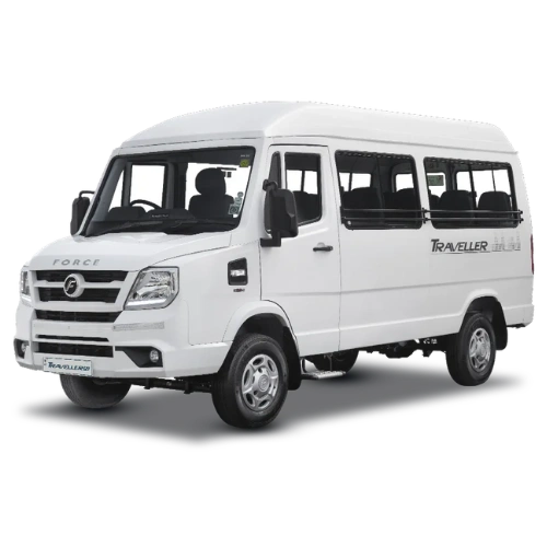
We run sedans, MUVs, SUVs, and tempo travellers for the Haridwar/Rishikesh/Dehradun to Sonprayag–Gaurikund leg of the Kedarnath Yatra — for solo travellers, families, and larger pilgrim groups alike. All vehicles come with an experienced hill-route driver. Fares vary by season, vehicle, and pickup point — call for a confirmed quote before booking.



Kedarnath Taxi Fare & Budget Guidance
Taxi fares for the Kedarnath leg depend on the vehicle type, your exact pickup city, the season, and whether it's a one-way drop or a round trip with waiting days included. The figures below are a rough planning snapshot, not a fixed quote — always confirm the exact fare on call before booking.
| Vehicle Type | Typical Use Case | What Affects the Fare |
|---|---|---|
| Sedan | 1–4 travellers, budget trip | Season, one-way vs. round trip, waiting days at Sonprayag |
| Ertiga | Small family, 4–6 travellers | Same as above, plus luggage load |
| Innova / Crysta | Family or elderly-friendly group, up to 7 | Peak-season demand, number of halts en route |
| Tempo Traveller | Group bookings, 9–17 travellers | Group size, multi-day Char Dham itinerary, toll & parking |
Prices may vary by season, vehicle condition, fuel rates, and availability, and typically run higher during peak yatra months (May–June) and around major festival dates. For an exact quote, call us directly or check the Haridwar to Sonprayag taxi fare guide.
Best Time to Visit Kedarnath
Kedarnath temple typically opens around late April or early May (traditionally on Akshaya Tritiya) and closes around late October or early-to-mid November (around Bhai Dooj), when the deity is ceremonially moved down to Ukhimath for the winter. Within this window, weather swings sharply with altitude and season — always carry warm layers regardless of when you travel.
Clear skies, manageable daytime temperatures, and the temple freshly reopened. Peak season — book taxis and stays well in advance.
Post-monsoon skies are usually clearer and crowds thin out, though nights turn noticeably colder as October progresses.
Heavy rain increases the risk of landslides and road blockages. Travel is possible but requires close tracking of advisories.
Kedarnath Yatra Registration
Char Dham Yatra registration, including for Kedarnath, is mandatory for pilgrims and is managed online through the Uttarakhand government's official Char Dham Yatra portal, along with registration counters at Haridwar, Rishikesh, and other transit points. Requirements and the process can change year to year, so always verify current rules close to your travel dates.
- Register online in advance through the official Uttarakhand Char Dham Yatra portal, or at designated physical counters en route.
- Carry a valid photo ID and keep both a digital and printed copy of your registration confirmation.
- Elderly travellers and those with pre-existing health conditions are generally advised to carry a basic medical fitness check and any regular medication.
- Vehicles also require a Uttarakhand entry pass/green card for the Char Dham route — see our Uttarakhand Green Card guide.
Travel Tips for the Kedarnath Yatra
A little planning goes a long way on this route. Keep these points in mind whether you're trekking yourself or travelling with elderly family members.
Begin the Gaurikund trek early in the morning to avoid afternoon fatigue, crowding, and sudden weather changes higher up.
Temperatures near the temple stay cool even in summer and drop sharply after sunset — carry a windproof jacket regardless of season.
Hill roads can be affected by landslides or temporary closures, especially in the monsoon — check current status before setting out each day.
Consider a pony, palki, or helicopter for the Gaurikund–Kedarnath stretch if walking the full distance isn't comfortable.
During peak season (May–June and around festivals), vehicles and rooms near Sonprayag/Guptkashi fill up quickly.
ATMs and pharmacies thin out past Guptkashi — carry sufficient cash and any personal medicines you may need.
Who Should Choose Which Option?
A private Innova or Ertiga for the road leg, paired with pony/palki or helicopter for the trek, keeps the trip comfortable and unhurried.
A sedan or shared taxi to Sonprayag, followed by the trek on foot, keeps costs down while avoiding bus timing constraints.
A tempo traveller works well for larger groups on a combined Char Dham itinerary, with everyone in one vehicle.
Kedarnath FAQs
How to go to Kedarnath?
Most pilgrims travel by road from Haridwar, Rishikesh, or Dehradun to Sonprayag/Gaurikund by private taxi or bus, then complete the final ~16–18 km stretch to the temple on foot, by pony, palki, or helicopter. Booking a dedicated taxi for the road leg is the most flexible option for families and groups.
How to reach Kedarnath?
Reach Haridwar or Rishikesh by train, or Dehradun's Jolly Grant airport by air, then continue by road to Sonprayag/Gaurikund. From there, the temple is accessed by trek, pony, palki, or helicopter, since no direct road or rail line reaches Kedarnath itself.
Is Kedarnath open now?
Kedarnath Temple is open only for part of the year, typically from around late April/early May to late October/early-to-mid November, depending on the annual opening and closing dates set by the temple committee. Outside this window the temple remains closed for winter. Always check the current year's official dates before planning your trip.
Where is Kedarnath?
Kedarnath is located in the Rudraprayag district of Uttarakhand, India, in the Garhwal Himalayas, on the bank of the Mandakini river at an elevation of roughly 3,583 metres, well beyond the last motorable point of Gaurikund/Sonprayag.
Who built Kedarnath Temple?
Local tradition links the temple's origins to the Pandavas of the Mahabharata, while the present stone structure is widely associated with a restoration credited to the 8th-century philosopher-saint Adi Shankaracharya. The exact original construction history is debated among historians.
What is the distance from Gaurikund to Kedarnath?
The Gaurikund to Kedarnath trek covers approximately 16–18 km of uphill mountain trail, typically taking 6–8 hours on foot. Pony, palki, and helicopter services are also available for this stretch.
What is the best time to visit Kedarnath?
May–June and September–October are generally considered the best months, offering clearer weather and manageable temperatures. July–August (monsoon) carries a higher risk of landslides and road disruption.
What is the distance from Kedarnath to Badrinath?
There's no direct road between the two shrines — pilgrims travel back via the Rudraprayag route, covering approximately 215–235 km by road, typically taking 8–10 hours depending on halts and road conditions.
Is registration required for the Kedarnath Yatra?
Yes. Char Dham Yatra registration, including for Kedarnath, is mandatory and is done online through the official Uttarakhand government portal or at registration counters along the route. Requirements can be updated each season, so confirm current rules before travelling.
Can I book a one-way taxi to Kedarnath (Sonprayag/Gaurikund)?
Yes, one-way taxi bookings from Haridwar, Rishikesh, or Dehradun to Sonprayag/Gaurikund are available, alongside round-trip and full Char Dham package bookings — call 9368028472 to check current availability and fare.
Explore More Char Dham Travel Guides