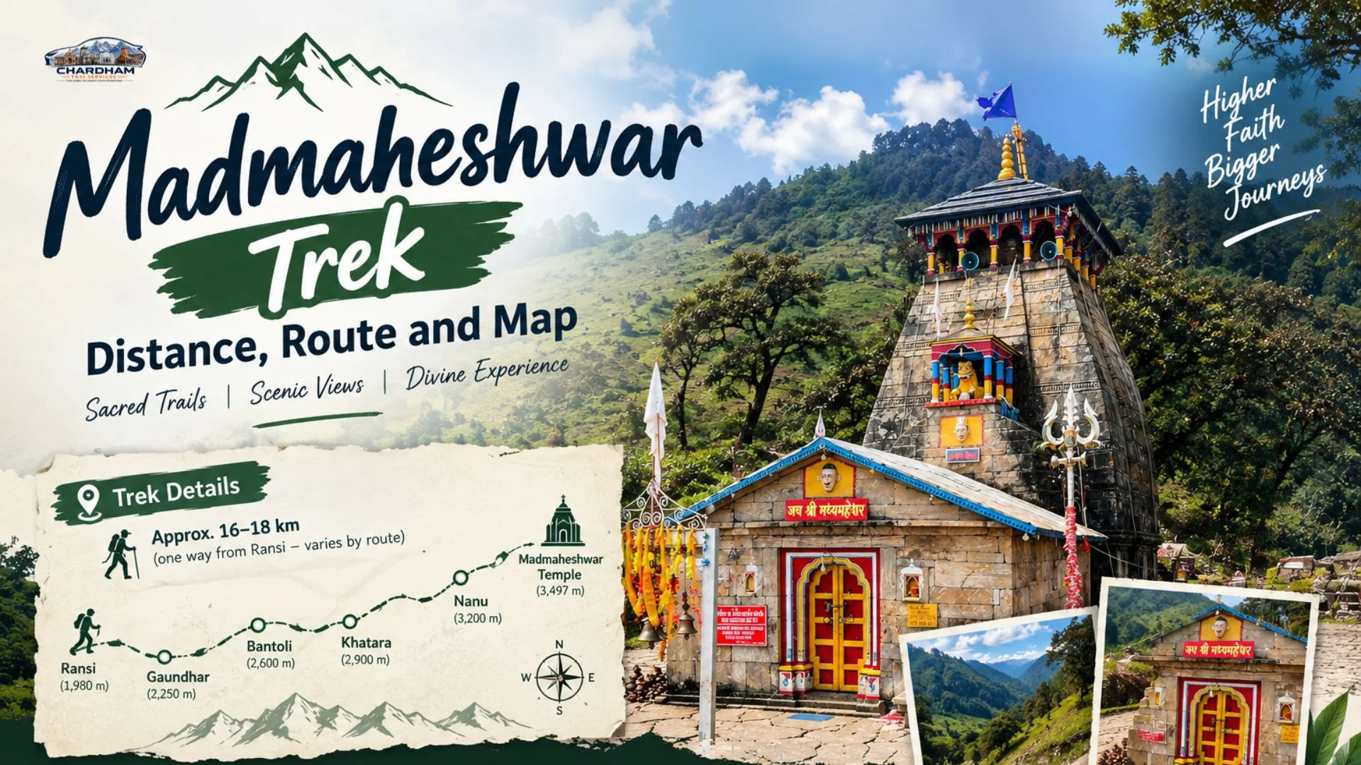
Standing at 3,289 m in the Mansuna valley of Rudraprayag district, Madmaheshwar is one of the most beautiful and least crowded pilgrimage treks in the Garhwal Himalayas. Most travellers first ask a very practical question: what is the real madmaheshwar trek distance, and how hard is it to walk? This guide answers that with a full stage-by-stage breakdown, an honest distance table, route options, seasons, safety notes, package costs and the road journey to the starting village, so you can plan the entire trip in one place.
The short answer is that the madmaheshwar trek is roughly 16–19 km one way from Ransi village, and most people finish it in two days up and one to two days down. The exact figure changes depending on the source, the season and which shortcuts are open, and we explain why further below. This article is written by the travel team at Chardham taxi services, the dedicated pilgrimage arm of DivyaShree Cabs, whose drivers make the run to Ransi and Ukhimath every single season.
Madmaheshwar Trek Distance at a Glance
If you only need the numbers, here they are. The madmaheshwar trek distance from the roadhead at Ransi to the shrine is about 16 to 19 km one way, so a full return is roughly 32 to 38 km on foot. Add the optional climb to Budha Madmaheshwar, and you walk another 4 km or so round trip from the main temple. Ukhimath, the winter home of the deity and the last proper town before the trek, is only about 10 to 15 km from Ransi by road.
| Detail | Approximate figure |
|---|---|
| Trek start point | Ransi village, near Ukhimath (Rudraprayag) |
| One-way trek distance | ~16–19 km (sources differ) |
| Return trek distance | ~32–38 km |
| Altitude of Madmaheshwar | ~3,289 m (about 10,790 ft) |
| Extra climb to Budha Madmaheshwar | ~2 km one way from the temple |
| Typical duration | 4–6 days including road travel |
| Difficulty | Moderate, with steep sustained sections |
| Best months | May–June and September–October |
Madmaheshwar Temple and Why the Madmaheshwar Trek Distance Is Worth Walking
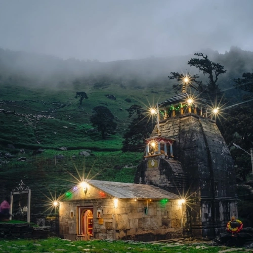
The madmaheshwar temple is the second of the five Panch Kedar shrines, after Kedarnath and before Tungnath, Rudranath and Kalpeshwar in the traditional order of worship. According to the Pandava legend, Lord Shiva fled in the form of a bull to avoid the Pandavas after the Kurukshetra war. When he was recognised and forced to dive underground, his body reappeared in five places. At Madmaheshwar, the middle part, the navel and belly, is worshipped, which is where the name comes from. The hump is at Kedarnath, the arms at Tungnath, the face at Rudranath and the hair at Kalpeshwar.
The stone shrine is built in the North Indian Nagara style, and the priests are traditionally from South India, in line with the customs set up by Adi Shankaracharya. The doli, or palanquin, of the deity travels from Ukhimath's Omkareshwar Temple to the shrine when it opens for the season and returns at the end of the pilgrimage period. Many people also refer to the same place as Madhyamaheshwar, and you will see both spellings on signboards, in Hindi sources and in booking pages.
What makes the madmaheshwar trek special is the scenery rather than crowds. The path climbs through oak and rhododendron forest, crosses the Madhyamaheshwar Ganga on wooden bridges, passes small villages and finally opens into a high meadow where the temple stands beneath the Chaukhamba massif. Unlike the Kedarnath route, there are no helicopters, ponies in convoy or queues, so the walk stays quiet and pilgrim-first.
Spiritually, pilgrims often combine it with the other four Kedar temples or with the main Kedarnath yatra. If you are already planning the Kedarnath side of the region, our guide to the Kedarnath temple explains timings and darshan basics that complement this trek.
Madmaheshwar Trek Distance Stage by Stage: Ransi to Madmaheshwar Temple
The trail is a single, clearly defined path from Ransi to the shrine. Below is the leg-by-leg breakdown most trekkers use. Distances are approximate and are hedged because the same section is sometimes counted from different bridges or village gates.
Ransi to Gaundar
~5–6 km · 2.5–3.5 hrs · gentle to moderate climbRansi is the last village reachable by road, and the trek begins here on a stone-paved village path. The trail runs along the Madhyamaheshwar Ganga through terraced fields and small Garhwali settlements. Gaundar is a good first tea stop, and many people also stay here on a slow, acclimatising itinerary.
Gaundar to Bantoli
~3–4 km · 2–3 hrs · steady ascentBeyond Gaundar the forest thickens and the climb becomes more constant, with a few steep, stepped sections. Bantoli is the junction where the path from Kalimath side joins the main trail, and it has homestays and small lodges. Many trekkers spend the first night here, which keeps the second day shorter.
Bantoli to Khatara
~2–3 km · 1.5–2 hrs · steep forest trailThis stretch is shorter but tiring, with a narrow trail cut through oak and rhododendron. Waterfalls and stream crossings appear regularly, and the air begins to feel noticeably thinner. Khatara is a small halt with a chai shop and a rest shed.
Khatara to Nanu Chatti
~2–3 km · 1.5–2 hrs · moderateThe trail flattens for short spells and opens to first views of the snow peaks on clear mornings. Nanu Chatti is a seasonal halt with basic food and a few tents or rooms. It is a popular last stop for a warm meal before the final climb.
Nanu Chatti to Madmaheshwar Temple
~3 km · 2–3 hrs · sustained climb, high altitudeThe last section climbs above the tree line into open alpine grass, with Chaukhamba rising ahead. Altitude effects such as headaches and short breath are most common here, so walk slowly and drink water. The stone temple appears in a wide green bowl, with a small cluster of lodges and dharamshalas nearby.
Madmaheshwar to Budha Madmaheshwar (optional)
~2 km one way · 1.5–2 hrs · steep, exposedAlso called Vridha Madhyamaheshwar, this small shrine is on a high ridge and sits above the main temple. The path is steeper and more exposed, and it is best done in the early morning for clear views of Chaukhamba, Neelkanth and Kedarnath peaks. Return to the temple by midday before weather builds.
Madmaheshwar Trek Distance Table: Route Chart and Related Treks
The table below gives the leg distances, altitude trend and time in one place, followed by a comparison with other Panch Kedar and Garhwal treks so you can put the numbers in context.
| Route / Leg | Distance (approx.) | Time (approx.) | Grade |
|---|---|---|---|
| Ransi → Gaundar | 5–6 km | 2.5–3.5 hrs | Easy–Moderate |
| Gaundar → Bantoli | 3–4 km | 2–3 hrs | Moderate |
| Bantoli → Khatara | 2–3 km | 1.5–2 hrs | Steep |
| Khatara → Nanu Chatti | 2–3 km | 1.5–2 hrs | Moderate |
| Nanu Chatti → Madmaheshwar | ~3 km | 2–3 hrs | Steep, high altitude |
| Total, Ransi → Madmaheshwar | ~16–19 km | 9–13 hrs walking | Moderate |
| Madmaheshwar → Budha Madmaheshwar | ~2 km | 1.5–2 hrs | Steep |
| Gaurikund → Kedarnath (for comparison) | ~16–18 km | 6–9 hrs | Moderate, paved |
| Chopta → Tungnath (related Panch Kedar) | ~3.5–4 km | 2–3 hrs | Easy–Moderate |
| Urgam → Kalpeshwar (related Panch Kedar) | ~1–2 km | Under 1 hr | Easy |
The comparison lines are useful for planning. Kedarnath is a similar length but has a maintained paved trail and heavy crowds, while Tungnath and Kalpeshwar are much shorter. The madmaheshwar trek distance places it in the middle, a real multi-day effort but not a technical mountaineering climb.
Budha Madmaheshwar: Extra Madmaheshwar Trek Distance Above the Main Shrine
Budha Madmaheshwar, sometimes written as Vridha Madhyamaheshwar, is the high pilgrim viewpoint that most people treat as an optional add-on. It lies roughly 2 km above the main shrine, with the altitude usually quoted between about 3,500 and 3,900 m depending on the source. That difference is another reason to treat all elevation numbers as estimates.
The reward is a wide meadow, a small stone shrine, a tiny pond and a completely open panorama. On a clear day you can see the Chaukhamba group, Neelkanth, Kedarnath Dome and the Mandani range. Local belief is that pilgrims who worship at the main temple should also visit this smaller sanctum, and the extra walk is the only part of the route where you will feel truly alone.
Distance, time and difficulty to Budha Madmaheshwar
From the temple, plan 1.5 to 2 hours up and about 1 hour down. The trail is steep, has loose sections, and is open to weather, so start early, carry a windproof layer and avoid it entirely if there is fresh snow or a thunderstorm forecast. Adding this leg to the base madmaheshwar trek distance gives you a total return walk of roughly 36 to 42 km from Ransi.
How to Reach Madhyamaheshwar: Madmaheshwar Trek Distance to Ransi by Road, Bus, Car and Train
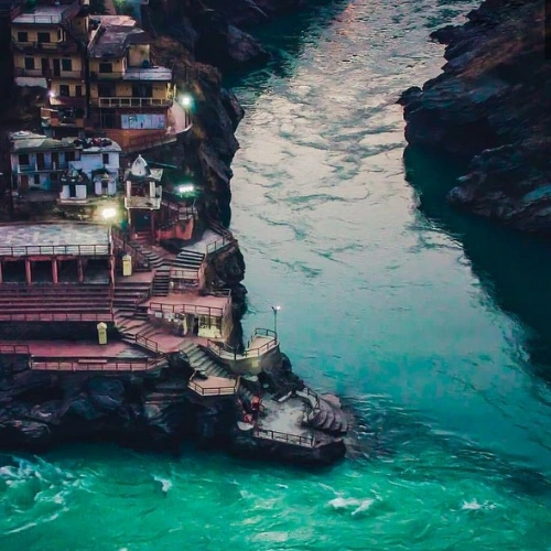
The madmaheshwar trek distance is only half of the journey, because the road leg to Ransi is long and mountainous. The standard approach is Haridwar or Rishikesh, then Devprayag, Rudraprayag and Guptkashi, then Ukhimath and finally Ransi. Anyone asking how to reach madhyamaheshwar should plan for a full day of road travel before the trek even begins.
By road from Haridwar, Rishikesh and Dehradun
By road is the only practical way to reach the trailhead. From Rishikesh it is roughly 205–215 km to Ransi in about 8 to 9 hours of driving, and from Haridwar it is about 230–240 km in 9 to 10 hours. Dehradun's Jolly Grant airport and Dehradun city are around 45 to 50 km further from the plains side in road terms, so add an hour or so from there. Our guide to the Rishikesh to Kedarnath distance covers the same mountain road up to Guptkashi, and the Haridwar to Kedarnath distance guide shows how far the route runs from the plains. For the Sonprayag stretch that many pilgrims combine with this trip, see the Haridwar to Sonprayag distance article.
By car or taxi
By car is the most comfortable option, and a private taxi lets you leave early, stop for tea at Devprayag and Rudraprayag, and avoid waiting for connections. Drivers from outside the state should also read our note on the green card for Uttarakhand, which explains the entry charge many outside-registered commercial vehicles have to pay. Booking with Chardham taxi services means the vehicle, driver and permits are already handled, and you can start from Haridwar, Rishikesh or Dehradun. If you are starting from the capital, our Delhi to Haridwar distance guide covers the first stretch, which is about 210–225 km depending on the route.
By bus
By bus, shared and state-run services run from Haridwar and Rishikesh to Rudraprayag, Guptkashi and Ukhimath. From Ukhimath you will need a shared jeep or local taxi to Ransi. This option is cheaper, but it takes longer, requires a change, and can be unpredictable in monsoon season when landslides slow the roads.
By train
By train, the nearest major railheads are Haridwar and Rishikesh (Yog Nagari), with Dehradun as another option. Haridwar has the best connections from Delhi and the rest of India. Once you arrive, you continue by road as described above. Avoid tight onward bookings, because road time on the hills is longer than it looks on a map.
By air
The closest airport is Jolly Grant in Dehradun. From there, it is a long drive via Rishikesh to Ransi, so most travellers land, rest, and start the mountain drive the next morning.
| Starting point | Distance to Ransi (approx.) | Drive time (approx.) |
|---|---|---|
| Ukhimath | 10–15 km | 30–45 min |
| Guptkashi | ~20–25 km | 1–1.5 hrs |
| Rudraprayag | ~65–70 km | 2.5–3 hrs |
| Rishikesh | ~205–215 km | 8–9 hrs |
| Haridwar | ~230–240 km | 9–10 hrs |
| Dehradun | ~250–260 km | 9.5–10.5 hrs |
| Delhi | ~440–460 km | 14–16 hrs |
Distance figures vary by a few kilometres depending on whether the route is taken via Agastmuni or the Kund side, so use these as planning values. Road closures, especially in monsoon, can add hours.
Best Time to Visit Madmaheshwar: Season-wise Madmaheshwar Trek Distance Conditions
The best time to visit madmaheshwar is from May to mid-June and again from mid-September to October. The temple opens in the summer pilgrimage period after the deity is carried up from Ukhimath and closes with the onset of winter, so exact dates change every year. Confirm the current opening and closing dates with the temple committee or your booking partner before finalising any tickets.
Summer (May–June)
Clear skies, snow patches on the upper route and long daylight hours. This is the most popular period, with more open lodges and reliable food stops. Evenings and nights are cold at the top.
Monsoon (July–August)
The meadows are green and flowers bloom, but landslides, slippery stone and river swelling are real risks. Most experienced guides discourage the trek unless the forecast is clear.
Autumn (Sept–Oct)
Many trekkers rate this the best time for crisp views, stable weather and clean air. Temperatures fall sharply at night, so bring warm layers.
Winter (Nov–April)
The shrine is closed, the trail is under snow and lodges shut. The deity's winter seat is Omkareshwar Temple in Ukhimath, which can be visited by road.
Choosing the right month also decides how long the walk feels. On snow-free trail in September, the madmaheshwar trek distance feels easier than the same 16 to 19 km in early May, when patches of snow and mud can slow you. Weather in the mountains changes quickly, so always keep a spare day in your schedule.
Madmaheshwar Trek Distance and Difficulty: Kedarnath vs Madmaheshwar Compared
Most people who ask which is harder, Kedarnath or Madmaheshwar, are comparing two treks of similar length. Kedarnath is about 16 to 18 km from Gaurikund on a wide, paved, busy trail with ponies, shops and medical posts. Madmaheshwar is about 16 to 19 km on a narrow forest and village trail with fewer facilities, fewer people and more steady climbing. For fitness, they are close, but for logistics and self-reliance the madmaheshwar trek is harder.
| Feature | Kedarnath | Madmaheshwar |
|---|---|---|
| Starting point | Gaurikund / Sonprayag side | Ransi village |
| One-way distance | ~16–18 km | ~16–19 km |
| Altitude | ~3,583 m | ~3,289 m |
| Trail type | Wide, paved, well maintained | Narrow stone and forest path |
| Crowds | Very high in season | Low |
| Ponies, palanquin, helicopter | Available | Limited local options |
| Facilities | Many lodges, food and medical posts | Basic lodges, tea huts and homestays |
| Best for | First-time pilgrims | Trekkers and quiet-seeking pilgrims |
What is the difficulty level of the Madmaheshwar trek?
Overall, the difficulty is moderate. There are no rope sections or technical climbs, but you gain about 1,600 m of altitude over two days with continuous ascent and sections of steep stone steps. Fitness, acclimatisation and a light pack matter more than trekking experience.
Is it beginner-friendly?
Yes, with preparation. Beginners with good general fitness, who walk 5 to 6 km regularly for several weeks, can complete it in three days with a guide. Anyone with heart, lung or knee problems should get a medical check first. If you want an easier first experience, pair a short Tungnath walk with a road visit to Ukhimath and then decide about Madmaheshwar.
Madmaheshwar Trek Distance Itinerary: 5-Day Plan From Haridwar
This itinerary is built around a comfortable pace, a reserve day and a proper acclimatisation night, which is how most guided groups run it.
Haridwar / Rishikesh to Ukhimath
~190–215 km · 8–9 hrs by taxiDrive via Devprayag, Rudraprayag and Guptkashi, and reach Ukhimath by evening. Visit Omkareshwar Temple, the winter seat of the deity, and rest early.
Ukhimath to Ransi, then trek to Bantoli
~10–15 km drive · ~8–10 km walkDrive to Ransi after breakfast and walk through Gaundar to Bantoli. Stay in a homestay and check hydration and altitude effects.
Bantoli to Madmaheshwar
~7–9 km · 5–7 hrsClimb through Khatara and Nanu Chatti to the temple, attend the evening aarti and stay near the shrine.
Budha Madmaheshwar and descent
~4 km round trip, then 8–10 km downGo up at sunrise to Budha Madmaheshwar and return to the temple, then descend towards Bantoli or all the way to Ransi if you are strong.
Ransi to Haridwar
~230–240 km · 9–10 hrsDrive back to Haridwar with rest stops. Keep the evening flexible for landslide delays.
If you also want to visit Kedarnath and Badrinath on the same trip, see the combined Kedarnath Badrinath tour package, and use the Char Dham Yatra route map to see how these places connect.
Madmaheshwar Trek Distance Map: Route Overview, Landmarks and Trail Markers
A simple mental map is enough for this route, because the madhyamaheshwar temple trek follows one main valley and one main path. From Ukhimath you drive to Ransi, then walk upstream along the Madhyamaheshwar Ganga (also called the Madhu Ganga). The trail never branches into a confusing web. The only real junction is at Bantoli, where a second path from the Kalimath side joins in, and even there the signage and local traffic make the direction obvious.
Key landmarks in order
Think of the route as six markers: Ransi (trailhead), Gaundar (first village halt), Bantoli (junction and first night stop), Khatara (forest halt), Nanu Chatti (last tea stop) and the temple meadow. Each of these is roughly 2 to 6 km from the next, which is why the madmaheshwar trek distance feels manageable when you think in stages and not in a single 16–19 km block. Distances between these markers are approximations, and some locals count them differently, so do not be alarmed if a shopkeeper's estimate differs from ours by a kilometre or two.
Reading the terrain
The lower section, up to Gaundar, is village trail with stone steps and terraced fields. Between Gaundar and Khatara the path enters dense forest and climbs steadily. After Nanu Chatti the trees end and the last hour or two is alpine meadow. Snow patches can linger on the upper part into early summer. You will cross streams and small bridges throughout, and the Ganga stays audible on your left or right for most of the walk. Offline maps and GPS apps help, but mobile signal is patchy above Bantoli, so download the route before you leave Ukhimath.
Madmaheshwar Trek Distance and Stay: Where to Eat and Sleep on the Route
Facilities on the route are simple but adequate. Most villages on the way offer homestays with basic rooms, warm dal-rice and tea, and the shrine area has lodges and dharamshalas that fill quickly in peak weeks. Rooms may have shared bathrooms, and hot water is sometimes limited, so expect a comfortable but rustic stay and carry a sleeping-bag liner if you are sensitive to cold.
Ransi and Gaundar
Small homestays and tea shops. Good for a first-night stop if you arrive in the afternoon and want to start fresh.
Bantoli and Khatara
The most popular overnight halts, with simple rooms and home-cooked meals at reasonable prices.
Nanu Chatti
Mostly tea, snacks and short stops. Rooms and tents are limited, so plan to eat rather than stay.
Madmaheshwar
Lodges and dharamshalas near the shrine. Book ahead if you are travelling in peak weeks, and carry your own warm layers.
Food is vegetarian and simple, and you should carry dry fruit, glucose biscuits and a few snacks. Cash is essential because digital payments rarely work at altitude. If you want to add sightseeing after the trek, our guide on the places to see during the Chardham tour is a handy reference, and it pairs well with a stop at Ukhimath for the Omkareshwar Temple, where the deity spends the winter months.
Respect for local customs matters here. This is a working pilgrimage route, not only an adventure trail, so dress modestly at the temple, keep noise low, avoid plastic and follow the temple staff's directions on darshan and photography.
Is the Madmaheshwar Trek Distance Safe? Packing List and Safety Tips
The madmaheshwar trek is generally safe for prepared trekkers, since the trail is a well-used pilgrim path with villages and tea huts at intervals. Most problems come from poor preparation: wrong footwear, an overloaded bag, rushed acclimatisation, or trekking in monsoon rain. Follow these rules and the risk stays low.
Footwear and clothing
Broken-in trekking shoes with grip, moisture-wicking layers, fleece, windproof jacket, gloves, cap and a rain poncho or waterproof shell.
Health and hydration
Water bottles, electrolyte sachets, glucose, personal medicines, sunscreen and lip balm. Speak to your doctor first about altitude medicines.
Documents and money
Photo ID, printed hotel or taxi confirmation and cash, since ATMs and UPI are unreliable above Ukhimath.
Gear and comfort
A 30–40 L backpack under 8 kg, trekking pole, headlamp, power bank and a small first-aid kit.
Safety rules that matter most
Start early each morning, keep a steady pace, and avoid walking after dark. Do not ignore headaches, nausea or breathlessness, because descending is the safest treatment for altitude sickness. Cross wet stone slabs and stream crossings slowly, never trek alone in bad weather, and check weather and road updates with your driver or host the night before. The route lies inside a protected wildlife area, so carry your waste out, do not feed animals and follow any forest-department entry rules that apply on your dates.
Also plan your road portion sensibly. Hill roads are narrow, and an experienced local driver from a reliable operator such as Chardham taxi services makes a large difference in comfort and safety, especially during the long drive from Haridwar.
Madmaheshwar Trek Distance Package Price: What Does the Trip Cost?
Package prices depend on group size, season, accommodation type and whether transport is included. As a rough planning guide, a guided 4 to 6 day Madmaheshwar package from Haridwar or Rishikesh often falls in the ₹8,000 to ₹18,000 per person range, while budget self-organised trips can cost less and premium private trips cost more. These are indicative ranges only, and the final price should be confirmed in writing.
Usually included
Stay at homestays or lodges, basic meals on the trek, a local guide, and sometimes porters and transport.
Usually not included
Personal expenses, extra snacks, tips, insurance, mule or porter charges beyond the agreed amount, and anything caused by weather delays.
Save money by travelling in a small group, choosing shoulder-season dates, and booking the road transfer as a shared vehicle. If you want a dependable vehicle for the road portion, you can compare rates with the Haridwar to Sonprayag taxi fare guide, since the first half of the drive follows the same road, and use the fare table below for a Ransi transfer.
Taxi for Madmaheshwar Trek Distance Plans: Sedan, Ertiga, Innova and Tempo Traveller
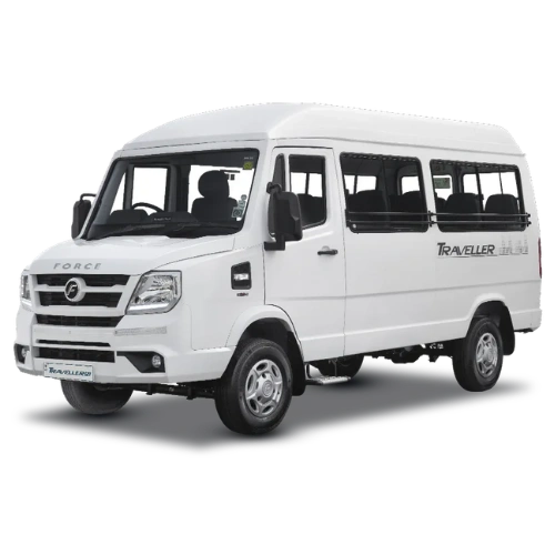
Because the madmaheshwar trek distance starts after a long mountain drive, the vehicle you choose matters. Pick by group size and luggage: a sedan for one or two people, an Ertiga for small families, an Innova for comfort on winding hill roads, and a Tempo Traveller for large groups. Every vehicle comes with an experienced Garhwal driver, and you can be picked up from Haridwar, Rishikesh, Dehradun or your hotel.
 1–3 Guests
Sedan
Economical and quick for solo travellers and couples with light bags.

 Most Comfortable
Innova
Powerful and smooth on steep hill roads, ideal for the long Ransi drive.
Why Choose Us for Your Madmaheshwar Trek Distance Journey by Taxi
Chardham taxi services is the dedicated pilgrimage arm of DivyaShree Cabs, and together we are trusted as the best taxi service for Char Dham and Uttarakhand tours. We have driven the Rishikesh to Ukhimath road thousands of times, so our drivers know where to stop, which stretches slide in the rains and when to leave to avoid closures. Read more about our team on the about us page.
Local Garhwal drivers
Drivers who live in the region, know the hairpins and can advise on weather and halts.
Clear, upfront pricing
You get a quote in advance, with tolls, driver charges and taxes explained.
Clean, serviced vehicles
Well-maintained cabs with AC, hill-tested tyres and luggage space.
24×7 support
A real person on call at 9368028472 if plans change or roads close.
We serve the whole route: see our taxi service in Haridwar for Chardham Yatra, our Haridwar hub, and the Dehradun to Char Dham taxi service for airport and city pickups.
Madmaheshwar Trek Distance Taxi Fare Table: Haridwar, Rishikesh and Dehradun to Ransi
The following fares are indicative one-way drop rates for the road leg to the start of the madmaheshwar trek. Prices vary by season, vehicle, toll charges, waiting time and whether you want a return pickup, so please call for your exact quote.
| Route | Distance | Sedan | Ertiga | Innova | Tempo Traveller |
|---|---|---|---|---|---|
| Haridwar → Ransi | ~230–240 km | ₹8,000–10,000 | ₹10,000–13,000 | ₹12,000–15,000 | ₹16,000–20,000 |
| Rishikesh → Ransi | ~205–215 km | ₹7,500–9,500 | ₹9,500–12,500 | ₹11,500–14,500 | ₹15,000–19,000 |
| Dehradun → Ransi | ~250–260 km | ₹9,000–11,000 | ₹11,000–14,000 | ₹13,000–16,000 | ₹17,000–21,000 |
| Haridwar → Ukhimath | ~200–215 km | ₹7,000–9,000 | ₹9,000–12,000 | ₹11,000–14,000 | ₹15,000–18,000 |
Plan Your Madmaheshwar Trek Distance Trip Today
Tell us your dates, group size and starting city, and we will suggest the right vehicle and route for your Madmaheshwar and Char Dham plans.
Madmaheshwar Trek Distance FAQs: Difficulty, Time, Season and Price
Which trek is harder, Kedarnath or Madmaheshwar?
Both are around 16–19 km one way, but Madmaheshwar is generally considered harder because the trail is narrower, more remote and has fewer facilities. Kedarnath is paved, crowded and supported by ponies and medical posts, while the madmaheshwar trek relies on your own fitness and planning.
What is the difficulty level of the Madmaheshwar Trek?
It is a moderate trek. There are no technical sections, but the route climbs continuously for two days and reaches about 3,289 m. Steep stone steps near Khatara and above Nanu Chatti are the toughest parts, and altitude affects some people at the top.
How much time will it take to complete the Madmaheshwar Trek?
Plan 2 to 3 days to reach the temple and 1 to 2 days to come down, so 4 to 5 days on foot with rest. A complete trip including the road journey from Haridwar or Rishikesh usually takes 5 to 6 days.
How long is the trek from Ransi to Madmaheshwar?
The trek from Ransi to Madmaheshwar is approximately 16–19 km one way, depending on the source and measuring points. It is normally divided into Ransi, Gaundar, Bantoli, Khatara, Nanu Chatti and the temple, with 9 to 13 hours of total walking time.
How long is the Madmaheshwar Trek?
The full madmaheshwar trek distance is about 32–38 km for the return journey from Ransi. If you add Budha Madmaheshwar, which is about 2 km above the main temple, the round trip becomes roughly 36–42 km.
Is the Madmaheshwar Trek beginner-friendly?
Yes, if you are reasonably fit and prepare for a few weeks by walking and stair-climbing. Beginners should take a guide, split the climb over two days and carry a light bag. People with heart, lung or joint issues should consult a doctor first.
Is the Madmaheshwar Trek safe?
Yes, in the proper season and with basic precautions. The trail is a regular pilgrim path with villages and tea huts, but landslides, slippery stone and altitude are real risks. Avoid heavy monsoon rain, start early and never trek alone in bad weather.
Which month is best for the Madmaheshwar Trek?
The best time to visit madmaheshwar is May to mid-June and mid-September to October, when weather is stable and views are clear. July and August bring heavy rain and landslides, and the temple is closed in winter.
What is the price of a Madmaheshwar Trek package?
Guided packages commonly range from about ₹8,000 to ₹18,000 per person for 4 to 6 days, depending on season, group size, stay type and whether transport is included. Call 9368028472 for a custom quote from Haridwar, Rishikesh or Dehradun.
Chat With Us on WhatsApp
Send your dates and group size, and we will reply with the best vehicle and fare for your Madmaheshwar trip.
Explore More Beyond the Madmaheshwar Trek Distance
Planning a longer Uttarakhand trip? These related guides from Chardham taxi services help you plan the rest of the journey.